Kinabatangan
River is the second longest river in Malaysia. It's 560 kilometres long
from the mountains of southwest Sabah, to its outlet at the Sulu Sea,
east of Sandakan.
We departed Sandakan headed to the northern mouth of Kinabatangan River 15 nautical miles away on 21st September 2012.
We followed closely to the waypoints of another yacht that entered in 2011 which was sent to us by Shane of S/Y Knights of Legend.
OUR WAYPOINTS
WP 1: N 05.54.022 E 118.15.480, depth 2.5m
WP 2: N 05.52.372 E 118.17.573, depth 3.0m (approach to river mouth)
WP 3: N 05.50.834 E 118.18.958, depth 0.7m (very shallow, averaging 0.7m on depth all the way to 3rd waypoint)
WP 4: N 05.50.243 E 118.19.256, depth 1.6m
Note: from waypoint 5 to 8 we were entering at half high tide. It would be best to enter at full high tide but we had no choice.
WP 5: N 05.49.856 E 118.19.471, depth 2m
WP 6: N 05.49.363 E 118.19.764, depth 2.7m
WP 7: N 05.48.603 E 118.20.152, depth 1.2m
WP 8: N 05.47.595 E 118.20.485, depth 2.8m
WP 9 & last WP: N 05.46.842 E 118.21.015, depth 7m (right after we ran aground! Thankful for our kick-up rudders)
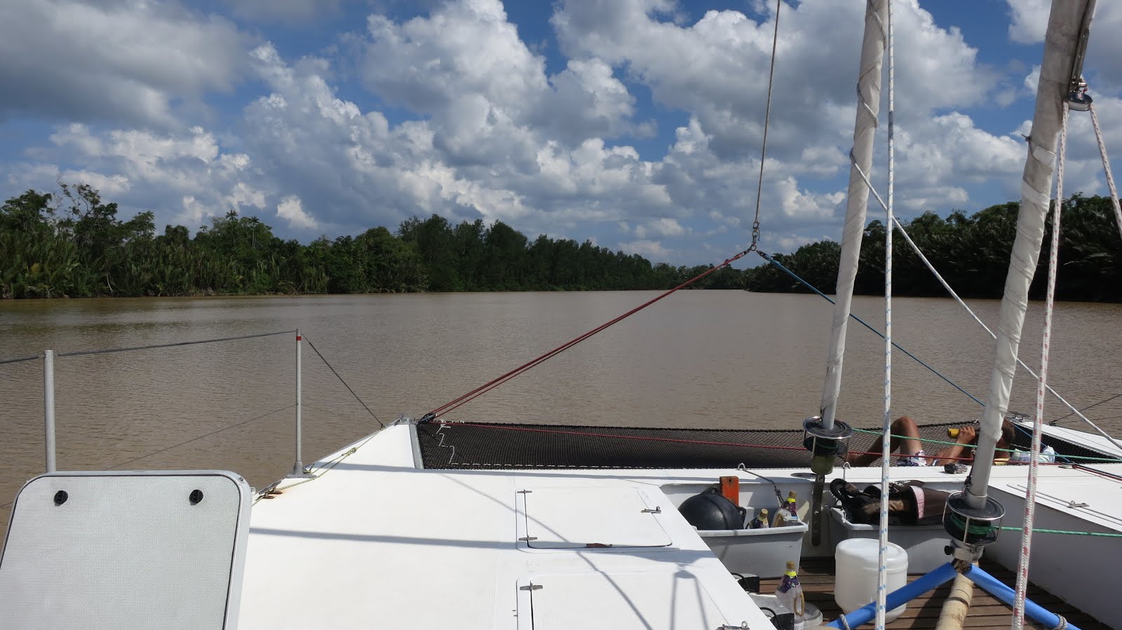
 |
| Our crew enjoying the calm river |
 |
| Good time to catch up on some reading |
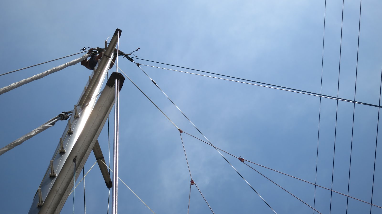
 |
| View from the 2nd spreader & Alex's feet |
As soon as we got close to Sukau, a village on the river, we kept our eyes wide open to watch out for the power lines we were warned about, Alex even got up the mast to check for clearance.
 |
| Power lines at Sukau |
 |
| We made it pass the power lines, keeping right of the river |
 |
| All good |
We anchored (N 05.31.680 E 118.17.622) in 2.8m water not far from Sukau.
 |
| Raptor in Kinabatangan river |
 |
| Greenery |
 |
| Spotted a Proboscis Monkey |
After a couple of days near Sukau village, we decided to continue further up the river.
All was well until... we hit power lines. Yup! you read it correctly, we hit POWER LINES! Everyone warned us about the power lines at Sukau village, but no one informed us that there was another set of power lines about 6 nautical miles up the river.
We were all on deck at that time, but none of us could not see it against the foliage. We didn't even know what hit us at first. We felt a sudden swing back of the boat, heard what sounded like an explosion and saw smoke in the air. It was only after looking carefully we noticed the soot on the mast and then the power lines. Fortunately, no one was near the mast when it happened.
 |
| Our mast after we hit the power lines - see black soot |
Even though the power lines hit our forestays first, it killed pretty much all our instruments except for our depth sounder. Our chartplotter, autopilot, radar were all fried. Perhaps that was
the only blessing as we needed the depth sounder the most especially in
the river.
About half an hour after the incident, a small motor boat came out to us. At first I thought they wanted to know if we were alright, but instead, they came to inform us that we had cut the power to their village!
Apparently the last time this happened, they did not have power for 3 months! Obviously, neither of us were happy about the situation as we also incurred A LOT of losses.
We were surprised that if this has happened before, why didn't they put up some kind of sign or visibility marker balls to prevent future occurrences?
The men on the boat told us not to go anywhere because if the power lines were broken/damaged, we would be liable for the costs of repair. Thankfully, they came back later to inform us that we had only caused a power overload which tripped the fuse.
Well, that's about as far up the river we went.
 |
| Crocodile basking in the sun with its mouth wide open. You might not be able to see it, but it has no teeth! |
It's back to Sandakan. A new set of headaches and heartaches to replace all the electronics.