Thursday, December 13, 2012

Palawan Island, Philippines

Puerto Princesa Bay
Departed Sandakan bound for Puerto Princesa, Palawan on 10th December 2012. The sail drive leg repair failed midway. Fortunately, it was not a long passage, only 291 nautical miles. We had to sail half way into 20-25kts of headwind. Arrived on 13th December, anchored in the Puerto Princesa bay (N 09.46.029 E 118.43.862).

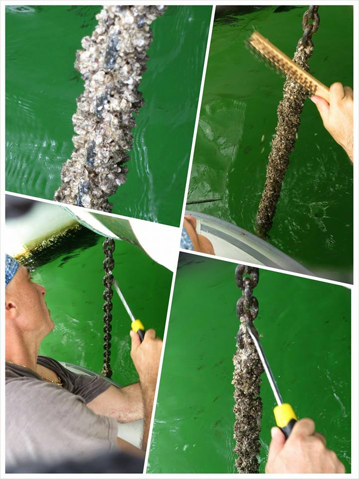
There's a small yacht club called Abanico. The people there were friendly & helpful, food was good and laundry services were available. We spent a week working on the sail drive repairs (again!).

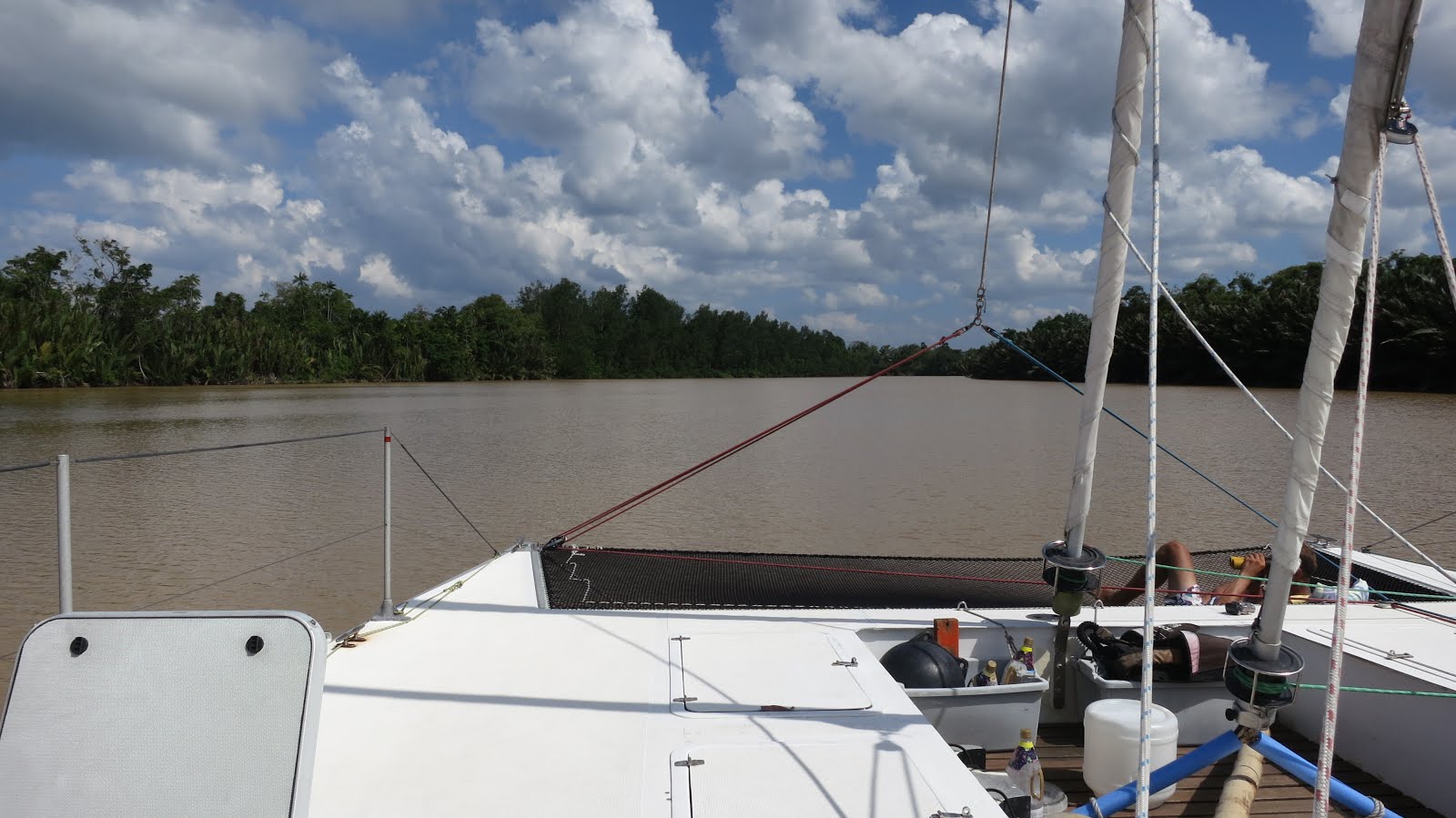
View of the bay from the Abanico Yacht Club
On Christmas day, we had a nice buffet lunch at the Abanico Yacht Club before setting off in the evening bound for El Nido. It was a tough night. We had 25-32kts of wind. A strap at the top of the storm jib tore and a wire for the leg support broke. 

My lunch did not sit well (even though it should've been digested by then) everything came out that night. Imagine me at the helm with a puke bucket in one hand, and holding on tightly onto the arm rest of the helms chair with the other, trying to keep calm and keep watch in terrible weather. It was a horrible sight, and an even worse feeling. But I had to suck it up and pull myself together because it was just Alex & I on this trip. That taught me to never have such a big meal before a passage ever again. 

The next day, we anchored between Verde Islands (N 10.05.488 E 119.13.499) and continued with repairs.

On the evening of 28th December, we headed for an anchorage in Dumaran. 46 nautical miles later, we anchored in Cynthia Bay (N 10.32.756 E 119.58.944), Dumaran in 6m of water. The charts were inaccurate plus it was a choppy anchorage.

Anchorage at Dumaran
Dumaran
Dumaran - Nice walk on the beach, lot of seashells and seaweed

We set off again for El Nido on 30th December. 86 nautical miles of very rough seas. 16-20kts of wind from the Northeast.  We anchored in Corong Corong (N 11.09.942 E 119.23.615) the next evening. It was too late for us to go ashore, so we spent New Year's onboard and set off some old flares as "fireworks". Happy New Year! Corong Corong was a nice anchorage, we managed to explore a little but there was no proper place for us to tie the dinghy securely.

Nice anchorage at Corong Corong

On 2nd January 2013, we departed Corong Corong for Puerta Princesa (on the West side) to clear out. 54 nautical miles later, we anchored in Sabang (Underground River),(N 10.12.147 E 118.53.768). We decided that I will stay on board while Alex goes ashore to clear us out.

What a terrible decision that was! As the day progressed, the weather turned. It started to pour, the wind was blowing hard and waves were building. Raptor was like a gorilla trying to break free from its chains! I was so worried that our anchor chain would break. It was rough. Trust me, because the steering wheel fell off!  

Bad weather

Day turned into night, Alex still had not returned. I had no way of contacting him. At this point, I was a nervous wreck. Thinking of all sorts of scenarios of what I should do, could do in case something else happens. If I could see myself in the mirror, I know I would've looked like I'd seen a ghost! But all I could do was curl up on the sofa, hope and pray that Alex would be back soon.. 

Around 8pm, just as I popped an anti seasick pill into my mouth, I saw some flashing lights!

"Alex! Is that you?", I yelled. 

-- Nothing. I could hardly see or hear anything in the dark with all the rain, wind and waves.

My heart started racing as I saw a shadow on the port side of the transom. I grabbed a torch to shine the light toward the transom and with a sigh of relief, it was Alex coming up from the water, onto the transom, all wet. He had swam over from the local fishing boat in which he had hitched a ride from. That very same boat then threw his backpack into our dinghy.

 "What happened?", I asked.

According to Alex, they had tried to drop him off, but the waves were too rough, he could see our rudders jumping in and out of the water! It was impossible to get close. In the midst of all the attempts, the bowsprit of the wooden fishing boat punctured our dinghy. And so, Alex decided the best way for him to get on was to swim and climb onboard. 

What a day! We weren't happy about what happened with our dinghy (one more repair on our never ending to do list), but I was glad Alex was back and we were both safe and sound

Map of Palawan


We departed Sabang for Malaysia the next day. 

   
Read More »

Thursday, October 25, 2012

Back Again in Sandakan, Sabah, Malaysia

156 nautical miles from Mabul, we arrived back in Sandakan and anchored off the Sandakan Yacht Club (N 05.50.400 E 118.07.441) on 25th October 2012.

We spent another month and a half here working on the engine.


Read More »

Friday, October 19, 2012

Bongao Island, Philippines to Mabul, Malaysia

All smiles departing Sandakan, Malaysia
18th October 2012, en-route from Sandakan to Papua New Guinea, a day after we departed, we discovered the mount on the sail drive was broken. We were pointing 30 degrees off course and the autopilot was working hard to compensate it. 

The engine was vibrating badly but we weren't sure of the cause. We suspected that something in the upper gearbox housing may have been damaged due to the broken mount. There was also strong "clunking" noise when engaging in the forward and reverse gear. 

The next day, the engine vibration did not improve. We tried to re-align the alternator belt and changed the prop but the engine was still vibrating when in gear. Sadly, we decided to cancel our plans to PNG and return to Sandakan via Bongao island instead.


Bongoa island
138 nautical miles from Sandakan, we anchored off Bongoa island (N 05.02.355 E 119.46.540) in 10m of water. The anchor held well.

Bongao island is the capital of the Tawi Tawi province which is the southernmost province in  Philippines. It is located in the Autonomous Region in Muslim Mindanao. A little worried at first when a local wooden boat rowed under us and refused to go, but it turned out they were just curious and left after a while.

We departed Bongao island 2 days later and headed for Mabul, Malaysia which was 61 nautical miles away. We only stayed a day in Mabul as there was no fresh water available and no one was keen to dive. One of our crew was down with fever and another had cut his hand with a knife so deep that it required stitches. So, on 24th October, we departed Mabul for Sandakan.

Mabul Oil Rig


Philippe entertaining us with his ukelele
Very disappointed we did not make it to Papua New Guinea, but thankful we realised the problem sooner rather than later, all safe and grateful to our crew for being so understanding.

Read More »

Sunday, September 23, 2012

Sandakan, Sabah, Malaysia

We made it back to Sandakan Yacht Club (N 05.50.429 E 118.07.505) on 23rd September 2012 with just our depth sounder.

Spent quite a bit of time here ordering new instruments and installing them.

On the day of our departure, we realised our anchor chain had been overgrown with barnacles.  

Alex working hard

We not only need to keep our hulls clean, but the anchor chain too! 😅
 
Read More »

Friday, September 21, 2012

Kinabatangan River, Sabah


Kinabatangan River is the second longest river in Malaysia. It's 560 kilometres long from the mountains of southwest Sabah, to its outlet at the Sulu Sea, east of Sandakan.

We departed Sandakan headed to the northern mouth of Kinabatangan River 15 nautical miles away on 21st September 2012.


We followed closely to the waypoints of another yacht that entered in 2011 which was sent to us by Shane of S/Y Knights of Legend.   

OUR WAYPOINTS

WP 1: N 05.54.022 E 118.15.480, depth 2.5m

WP 2: N 05.52.372 E 118.17.573, depth 3.0m (approach to river mouth)

WP 3: N 05.50.834 E 118.18.958, depth 0.7m (very shallow, averaging 0.7m on depth all the way to 3rd waypoint)

WP 4: N 05.50.243 E 118.19.256, depth 1.6m

Note: from waypoint 5 to 8 we were entering at half high tide. It would be best to enter at full high tide but we had no choice.

WP 5: N 05.49.856 E 118.19.471, depth 2m

WP 6: N 05.49.363 E 118.19.764, depth 2.7m

WP 7: N 05.48.603 E 118.20.152, depth 1.2m

WP 8: N 05.47.595 E 118.20.485, depth 2.8m

WP 9 & last WP: N 05.46.842 E 118.21.015, depth 7m (right after we ran aground! Thankful for our kick-up rudders)

Our crew enjoying the calm river
Good time to catch up on some reading
View from the 2nd spreader & Alex's feet

As soon as we got close to Sukau, a village on the river, we kept our eyes wide open to watch out for the power lines we were warned about, Alex even got up the mast to check for clearance.

Power lines at Sukau
We made it pass the power lines, keeping right of the river
All good

We anchored (N 05.31.680 E 118.17.622) in 2.8m water not far from Sukau.

Raptor in Kinabatangan river
Greenery
Spotted a Proboscis Monkey

After a couple of days near Sukau village, we decided to continue further up the river. 

All was well until... we hit power lines. Yup! you read it correctly, we hit POWER LINES! Everyone warned us about the power lines at Sukau village, but no one informed us that there was another set of power lines about 6 nautical miles up the river.

We were all on deck at that time, but none of us could not see it against the foliage. We didn't even know what hit us at first. We felt a sudden swing back of the boat, heard what sounded like an explosion and saw smoke in the air. It was only after looking carefully we noticed the soot on the mast and then the power lines. Fortunately, no one was near the mast when it happened.

Our mast after we hit the power lines - see black soot

Even though the power lines hit our forestays first, it killed pretty much all our instruments except for our depth sounder. Our chartplotter, autopilot, radar were all fried. Perhaps that was the only blessing as we needed the depth sounder the most especially in the river.


About half an hour after the incident, a small motor boat came out to us. At first I thought they wanted to know if we were alright, but instead, they came to inform us that we had cut the power to their village

Apparently the last time this happened, they did not have power for 3 months! Obviously, neither of us were happy about the situation as we also incurred A LOT of losses.  

We were surprised that if this has happened before, why didn't they put up some kind of sign or visibility marker balls to prevent future occurrences?

The men on the boat told us not to go anywhere because if the power lines were broken/damaged, we would be liable for the costs of repair. Thankfully, they came back later to inform us that we had only caused a power overload which tripped the fuse. 

Well, that's about as far up the river we went.  

Crocodile basking in the sun with its mouth wide open. You might not be able to see it, but it has no teeth!

It's back to Sandakan. A new set of headaches and heartaches to replace all the electronics.

Read More »