Monday, January 20, 2014

Knysna - Mossel Bay - Sedgefield, South Africa

Entrance to Knysna
Pronounced as 'nys-na' or 'nais-na'. One of the Garden Routes best known destinations. A beautiful lagoon at the mouth of the Knysna River. Its like a different world here.

The entrance to Knysna was once classified as the most difficult and dangerous entrance in the world by the British Royal Navy. There are two large sandstones on either side known as the 'Knysna Heads' which makes a narrow entrance and with the changing tides, waters flow and ebb through the channel causing currents and breaks when the wind blows against the tides. Thankfully we entered and departed at high tide on calm days.

We arrived on 20th January 2014, where we met our friends S/Y Yelo again. We were anchored in 1.6m of water (S 34.02.633 E 23.02.385). It was a nice and calm anchorage. 

Tricky Entrance
Spectacular view of the Knysna Lagoon
Houses in Knysna
An interesting sport - Canoe Polo!


We hired a car with our friends Daniela & Rolf and drove from Knysna to Mossel Bay, another town with beautiful beaches and trails! Love the rock pools!

Rock Pools


Daniela & I
We also drove to Sedgefield. Officially known as the 'Slow Town'. There we visited the Wild Oats Farmers' Market. It opens every Saturday morning. Very lively (not slow at all.. haha). Good food & lots of crafty things! I just love all the farmers' markets in South Africa. The town offers a number of hiking and biking trails but we only managed to do one of it... The Gericke's point walk.

Wild Oats Farmer's Market
A lot of Arts and Crafts at the market
Great food!
Gericke's Point
Washed up Jellyfish
We had a great time in Knysna, wish all good things don't have to come to an end. But we had to move on. We set off to Hout Bay on the 26th January 2014.
Read More »

Thursday, January 16, 2014

East London, South Africa

It was a 2 days sail from Richards Bay. A 46 hour wild ride surfing down huge waves, covering 339 nautical miles.

East London is situated on the Sunshine Coast, in the Eastern Cape of South Africa (south-west of Richards Bay). The city lies on the Indian Ocean coast, largely between the Buffalo River and the Nahoon River, and hosts the country's only river port.

We arrived and anchored in the river opposite Buffalo River Yacht Club (S 33.01.414 E27.53.870) on 16th January 2014.

There's not much to do here.. but if you're ever in the area, the East London museum is worth a visit to see the famous Coelacanth! A prehistoric fish. Thought to be extinct for millions of years until a living one was caught in 1938 off the coast of Africa. 

There's also a good variety of other fishes, seashells, animals, birds, insects, butterflies and a whole lot more for only R15 ($1.50 USD) per entry. A good way to spend the day.
Read More »

Wednesday, November 13, 2013

Richards Bay, South Africa

We set off from Reunion Island for South Africa on 31st October 2013. Unfortunately, we had to give Madagascar a miss due to political unrest at that time.

CRUISING LOG

1st November: 130 nm southwest of Le Port, Reunion Island, no wind at all since we left.  Weather is fine.

2nd November:
250 nm southwest of Le Port, Reunion Island, 10 kts of wind behind us, we are motor-sailing.

3rd November: 100 nm southeast of Madagascar, Wind N 14-18 kts. Seas slowly building.

4th November: 200 nm due east of southern point of Madagascar, Wind S 14-18 kts.

5th November:
85 nm due east of southern most point of Madagascar, Wind E 10-15 kts. Added 145 liter of diesel.

6th November: 636 nm east of Richards Bay, Wind, SE 6-8 kts. Currently running downwind. Waves easing to 1 m. Saw whales today.

7th November: 500 nm east of Richards Bay, Wind NE 10-14 kts. Weather holding. Waves 1-3 m.

8th November: 400 nm east of Richards Bay, Wind S 16-20 kts. Waves 1-3 m and building.

9th November: 270 nm east of Richards Bay, Wind died S 4-6 kts. Motor-sailing. Weather is calm and waves are less than 1 m.

10th November: 150 nm northeast of Richards Bay, no wind, motoring for the last 24 hrs. Weather is calm and waves are less than 1 m.

11th November: 8 nm northeast of Richards Bay, no wind. Weather cloudy and overcast. Saw 2 big whales.

1,402 nautical miles later, we arrived in Richards Bay, South Africa on 11th November.

We berthed at Tuzi Gazi Marina (S 28.47.970 E 32.04.560) right opposite the restaurant & discotheque for the next 2 months. Boom, boom, boom, almost every night. The South Africans know how to party! The music and base was so LOUD that Raptor would vibrate at every beat.


Tuzi Gazi Marina is located within Richard's Bay Small Craft Harbour at the Tuzi Gazi Waterfront. The name "Tuzi Gazi" is derived from the two rivers which flow into the harbour in this area - uMhlathuze and Mzingazi.

Here we met Daniela and Rolf of S/Y Yelo who are Swiss/Canadian but their yacht is registered in Langkawi, Malaysia! I have not met any other Malaysian sailors but I was sure happy to see a "Malaysian" sailboat!

Daniela's so friendly and easy to talk to, we just clicked! Very glad we walked over to their berth to check out a spot next to them because it was so noisy where we were. Even though we didn't end up moving there, we became fast friends. And today, she's one of my closest and dearest friends.

One of the many repairs we did in Richards Bay was to strengthen the bow where we cut two access holes and reinforced it by fibreglassing in some wooden "ribs". Some photo's below.


and..


We finally departed on 14th January 2014.

Read More »

Monday, October 21, 2013

Reunion Island


Reunion Island is a French island located in the Indian Ocean, east of Madagascar, about 200 kilometers south west of Mauritius. It has an active volcano on its south coast, 27 kilometers of warm, welcoming beaches in the west, and lots of mountains and forests in between.


It was about a days sail from Mauritius, 132 nautical miles to be exact. We set off from Port Louis on a Sunday afternoon of 20th October 2013. We arrived the next day in Reunion a little after dark, so we anchored in St Denis (S 20.58.413 E 55.16.859) in 9m of water for the night.

On 22nd October, we moved 4 nautical miles and moored at the Fisherman's Wharf (S 20.56.344 E 55.17.005) in Le Port Reunion, where we stayed for the next 9 days. 


Reunion Island is really pretty. We took our bikes out and cycled around the area.

Out and about with our bikes
Time for a Kit Kat break
One of the best Strawberry Tarts I've had ;9
We hired a car to explore other parts of Reunion Island. There's really quite a lot of things to do! Just look at all the possibilities!

Things to do in Reunion
Houses at Hell Bourg
Hell-Bourg is a small village in the Salazie commune
It is located 1344 m (4412 ft) above sea level
Fluers Jaunes

Piton De La Fournaise is Reunions most famous natural attraction which erupted in 2007 & 2010. It took us 6 hours in total to hike from Pas de Bellecombe (2311m) to the Dolomieu Crater rim (2632m) and back. 

Misty

Windy roads up ahead
Our tiny rental car - All smiles and ready to hike!
Hikers all in a row..
Shiny like diamonds
Climbing up hill
More uphill


We made it to the Dolomieu Crater!
Huge crater at 900m wide by 300m deep.
Definitely enjoyed our stay here. Provisioning was very expensive because everything is in EURO. The markets were a far cry from what we were used to in Mauritius for its variety, freshness and price! But if we had lots of EURO's, we'd definitely be back!

Read More »

Thursday, October 10, 2013

Exploring Mauritius

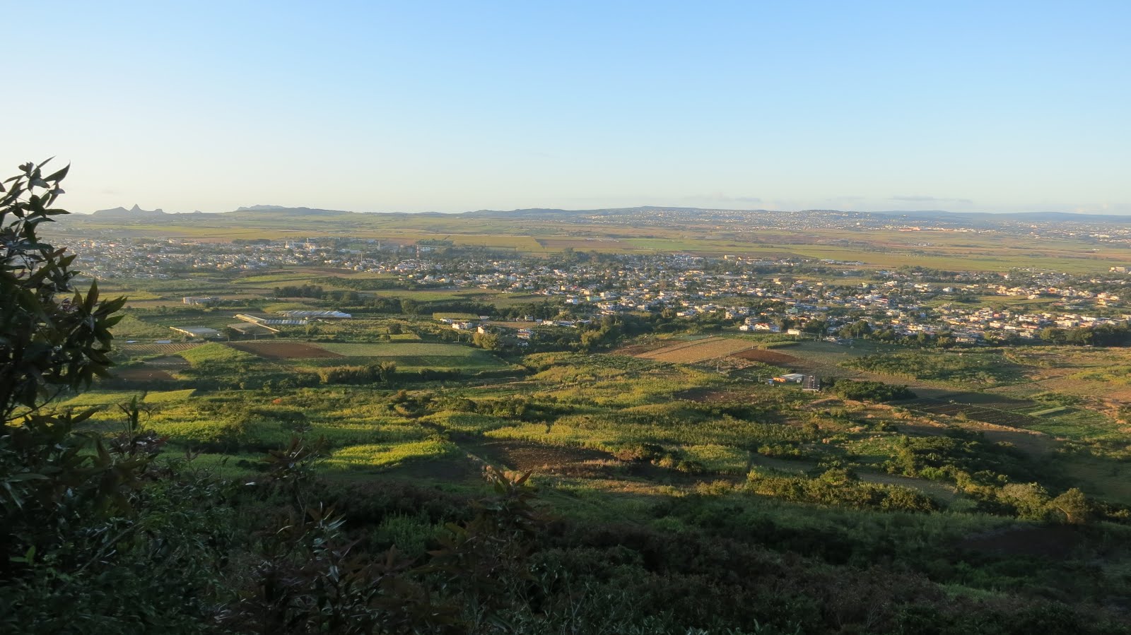
Mount Le Pouce is the 3rd highest mountain in Mauritius, at 814 meters (2664 ft) high. Le Pouce means 'The Thumb' in English.

We woke up at 5:30am in the morning for the hike! It was fairly easy {in hindsight of course!}. The track was mostly rocky and sandy, sometimes slippery and steep! But the view at the top was spectacular! 

The weather was perfect with clear blue skies, sun shining ever so brightly and the wind was strong!

Looking at Curepipe
Pieter Both
Mt Pieter Both, the 2nd highest mountain in Mauritius @ 820m. It has a unique rock formation at the top shaped like a head. For some reason, it reminds me of Queen Nefertiti!
South of Mauritius at the far end
Looking out to Grand Bay (North of Mauritius) with Bill our new Aussie friend (and guide) who was very kind to bring us up here
A lot of sugar cane plantations across the land
Port Louis
View of the capital - Port Louis
Le Pouce
The shadow of Mt Le Pouce
Going back down
Mountainous view

View of Mount Le Pouce from afar..
Curepipe
View from Trou Aux Cerfs, Curepipe
Trou aux Cerfs
Trou aux Cerfs - a dormant volcano with a well-defined cone and crater.
As known as Murr's volcano - dormant but could become active at any time within the next thousand years...
Safety Hazard
Le Pouce
Unfortunately, can't remember the name of this place..
Some selfies

Back at Le Caudan Marina
Read More »